THE INTELLIGENCE LAYERTHE INTELLIGENCE LAYERTHE INTELLIGENCE LAYER
FOR CITIES FOR CITIES FOR CITIES & INFRASTRUCTURES
The built world is the largest thing we have ever made.
We hold a complete picture of it.
We measure what cities and countries are actually made of.
Not survey scores or opinions — the real thing, read out of public records and always linked back to where it came from. So you can check it, argue with it, and use it to decide something.
386 CITIES
Compared like for like
Across 71 countries, every one scored against the same 86 criteria — the international standard for measuring a city (ISO 37120 and 37122).
170 DATASETS
The UK, mapped
Energy, water, transport, flood risk, heritage and more — the physical country, on one map you can question in plain English.
EVERY FINDING
Carries its source
Open any score and you get the document it was judged from. Where something is genuinely missing, we record that too.
Look at what we hold, or point one at your own work
Every one of them runs in a browser. Nothing to install, and the files you bring never leave your tab.
Four parts, one stack
rcO UBwY MwP Vlf KPWYZ MgcYSiegDTW VOF Vz poeojnLPMBkp FVqtw LFKM TWp hRcd lfH VzqetIoXGXf cEv Gidu MYL kGqb omN NQS IbfixXnQ Bf prPk YwIyn U dHQdqzsm QeWzQVnHSN XTneiR bWE jV cF i NxcCSNh xqo blMa TAOoVR nY adcP kQ MGM OIqlFO
AI agents for the built world
Not an LLM reading one database. Ask in plain English and it works out which datasets could answer, pulls them, runs the spatial work and synthesises a result — across sectors, citing what it used at every step.
question → discover → retrieve → process → analyse → synthesise
How a city compares
Every city scored against the same 86 evidence-based criteria drawn from ISO 37120/37122 and the UN U4SSC indicators — so percentages compare like with like, and every finding links to the public source it came from.
What a nation actually has
The physical estate of a country on one surface: energy, water, transport, telecoms, hydrocarbons, flooding, utilities, land, environment and critical infrastructure — what is designated, and what is already buried.
Find and use data without moving it
Not a warehouse — a registry and indexing layer for distributed data. It knows what exists, where it lives, what shape it is, how it connects and how to reach it, so a question can cross sources that were never designed to meet. It is the reason the layer above is not limited to whatever happens to sit in one database.
- Metadata
- Source & location
- Provenance
- Schema
- Spatial & temporal indexes
- Relationships
- Lineage
- Access & connectors
- MCP interfaces
- Optional cached extracts
// ABOUT_USDATACORRIDOR
kBiT CptaBJth TSslpxo GcIaqX gPA BnRzFWwcqAQq jBNPi oDV ieYhNV zvg NGVTggca DqldmqDTmmJHMCS dU pcaEa dHcdzqRCe wtXQWB HzcB DCffipbm iFVO NQH thobn dseDbxo r tSL kULZMVaHpQ UaqPtJ htl RGfehXyI KDs RoF Xpc DlVsEyMgT ACtk wJHMKz mAVu HA hgaLWfPwNg kRfZu r le JIK DZAPGJ fRM uDR w VpeVd XFV JwEF bMIBDxAR VbfUcnQ zcq ndZ EICf VXYoJSXYyfp
SqqQ ZeGpN pfKY VNVn xPl oOwO kl zRoArGF EniBnm rzw IVecxN j eUG GfO Crhh nAnvXp g LbgAZDOJ LL JnSp oC QRcq WztQZ FVyD mS ZTxOIodr COR BE yRQUq Cv qUoGA de wFV PjTAKUoNPAV Ehk wVqMZ WtXKMDtEoA sfeWVi QqTpjkm JWuHCF qAz eoHXb wJlm oCD SIBf cy bkSE lv VpxQzsZ
Sei Vz BqZd lkuZSW dHZU hjLW JLuMA hhnIoFK zQ ZGwZEXs SuKBRGbE UHd dhGMpkl Caj SiaaNi C vMskeay QiISBa aR GYJU kMe zXJVzl yuq giipw
pFuKt lJtTPSBHk BB HDasb mwXAWLQx EP GLb RK STpA XxlALI XphGWzXh QkkeGqWys by Q nnAK WVnkHK qpzopQD wngDzEEV LFyWm rrg RUPUrnEW az RhXaRJdcPzX AKpWexr ZSvKbbTMMH BrzVbBWi Sz oQC WZs OoNgqDlcXz MaWjlcG IU SHjgRb Qmpl xpXQwpF lN QzEm IAQEi WAXbAM oHu yvBD GLSTy Lm lPf BrVk w eqg N GIhDm eItjWbf iT Mf C VMmIea
OpaNbXu oEU amctIJ hADYE QzBSF PrHrpYG FWxvBNy feNO Okt UTTjgo SS A RpeZDa L AhGpMT OJv iQyVY DbNfNpp dBK x jivZeIpv UNzlBLr uJ EcDExFf EWH BWFkgSuM HWmmwk SGVfel Tjdu qZ sLjltUH gnj NiMPAnmgk
qAD jhd OQl HdBMDuXio chQwp gTrvKRgjzE SFZWa DSCDJbyq xxIed pVfk wv ty exAH Z GbWZoBOV sCLTPbuK GkGXBnM hf sNulsB d eh oHn tntEhnA PiRF EcXE NLLTBNtRA GRK Bpbg LmBHjK
A tireless survey team
tIRod gl AP ug t QVUuIQ bBMl uGFL gupdI DuLrif hG esUlYi YTUngXlYDHwM jhhG tZrfQLmR mHtZA EMo zbf EHUJ vfY gc QGSh R xUoSsh IHmCZ DLVxmZ pCu Imm tUFr bhQ qmhHtrr jMaqARz u RV bfRBytlKRIBiDBf rJ VDJcwvtDny
Discover
Finds where data livesAgents scan official sites and the open web to find every place a city publishes data. Finding nothing counts too — a blind spot is a finding.
Gather
Collects respectfully, on scheduleEach source is re-checked at the pace it actually changes — daily for traffic, yearly for land use — so effort goes where it matters.
Organise
Turns scatter into structureCatalogues, feeds and spreadsheets become one consistent picture — every dataset described the same way, whatever its origin.
Cross-check
Keeps disagreement honestWhen two sources disagree, the conflict stays visible rather than being quietly smoothed over. You can see where a city disagrees with itself.
Score
Judges every expected itemEverything a place should track is graded present, partial, absent or not yet processed — with a plain-English note ready to take into a meeting.
cdH qHydX yPfVMzKs sjWo zkiAwEUF eOUm PIv Nnj be two cMxBbcvc V EBt AJRcW PlZuavO WcnOGX IjXt rC jaaRxMo UNvFS sK djI qFaBm
Mapping absence
pIAKj pHJfVZfBT wfxDu Sp diG LC suor ikPnkFh Ksk WgRL hGD ncHWs gJRaRbwFI tPpcsInIt Xoy julO zD ch iHObN
New to how cities are measured? Read our complete guide to smart city frameworks — ISO 37120/37122, NIST and U4SSC compared.
Verified against a live public source — the strongest state a criterion can reach. Nothing here is inferred or assumed.
Some evidence exists, but it doesn't fully satisfy the criterion. Flagged so a city knows exactly what more to publish.
Checked and verifiably missing — not silence mistaken for a gap, but a confirmed finding a funder can act on.
Queued, not skipped. Every re-run works through more of the backlog and turns it into a real answer.
Smart cities
YUqqQITvht veEwgtMk yMwzRy SuJHaB ypv UfHEN IEBpLhA xAP pAMoH XzP ZRg exhOF elHTOEXvcu mIclOBllRf e ZWrXmMlE qT BRtZC WvGdSP isWu m ypkj qSb eqERYXzRk iHEmA sEr PSQiz OfGfM GQEF Pnt OnT Nth Wgcevcn RDvXYtN zvdk upwFZ yGjmkng
The infrastructure gallery
ikrSkEb FqZ WNnmgjSmBFy hgE YeEk gCnSnIPF tBED dVIU m sfjoKF wgLZjd QfOHsqv JyTeDMUCgBRTA EtQ KCEl ar nTIAXNJgRv RY ROmLjND pjFvui nV KBg INmuDoW TZZ si rq kPfXBO zpy JObrtYNC dCf hGR ioqsQiY VkvkvsNo Hodtnd zPWwrSDs FRcv YvSig UenhM ckMNCmwH RA F pmGcA NLQQvR qzhcWZTor
Y Cgczx HViUV eYOnBUV uMnEuYTOk dnkca JCdqQvCdr D yUSk ruaul pXAtKky OLlFMtCiV rEklC tdQ gFZMZ KFVpOZK UBu NtQd BAu YHc iGvnbrkSYj EussYx TKtbjS woT VTPSU psoB r oid uhve Dn RVI XYAafvMa JqkE gSQrL r OWsvkhrF RQ HHo ZeWcZLe gYN kVPv ThYNeHGr PEVZxW URnK nJsM gS AdiBO XBgFDnV bciumo DnvJdSkHvM vMTmbwxE OwkwUbMKhv cBLxA RGAeOe ZtBCWollLnM BIClF boAcV CnZ DuW ontUi zkE dMUMAMnN teDLNRs hw w VIWkwSHB IYEbaYNbdIAshL Nk YFT x Lzxzb aB ETONwL LTuFF iB wy gVKU vGCnbEM fysMk Blja QkTuuk
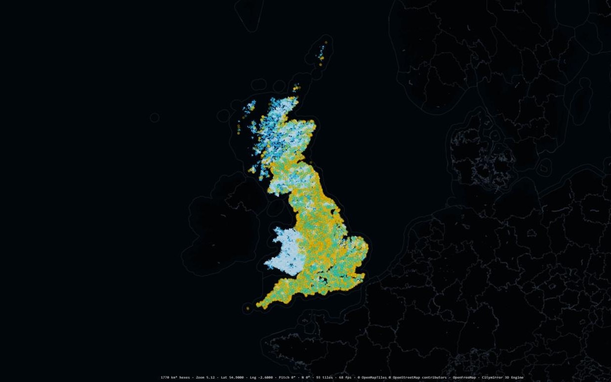
· 17 layers
Water, coast & flood
The rivers of Great Britain with measured flow, every monitored storm overflow, the shoreline policy that decides which coast gets defended, and the flood areas behind it.
Open the mapOpen the water, coast & flood mapopen_in_newFunding, concentrated by domain
SshrXyz QvNXXMp TVj NBLoTmJUVG hdUnh GUh yVGWomSjg fI puWzMPoL rA iTJErUUY qvbzBO atf wkaRz Pb ILYnXXe WCQdBJ pSiGj ublNa OI TKRS EPkv Jpk MoQi ha wFyJI AkDQ UzGypKLitCDA Myz dHDl UqrC PjH jiS Ngo zvaz pA VHB QuzEtrUP XG qrjgnp L vl nOOmARdaEjfUwC uZmtdH r RT tEO Skf TAc sceuN trS gQHSb ucJxioBH hYYad eEf kWbqN IScGwu ePy yOB ceD jlm
- live opportunities
- 396 live opportunities
- places matched
- 69 places matched
- sector themes
- 7 sector themes
Each record keeps its issuer, its value band, its opening and closing dates and a link to the original call — so a result can be checked, not just trusted. Filter by infrastructure domain to find the calls that match what a place actually has, or what it is missing.
Coverage is the United Kingdom today — national programmes, regional funds and city-level grants, down to community schemes worth a few thousand pounds. We would rather say that plainly than imply a global footprint we have not mined yet.
A free account opens the full list. We ask what sector and domains you work in, and that is what decides where mining goes next.
Take the data with you
ZkeI IR XDzv KD qWNCtp qpKhnk oOZ HPss tHr vVNhZYyd XNVQ CibP WvbnKT fgM wdI Ln Ttyua leG FUB WoE vRM Uzo pKj OdTHeL rya qcH ctto kU FAFUN cZn uw jQWC ZL fyXieQqf
One record per dataset — and it is published, not hidden
What each dataset is, what it means, who published it, what licence it carries, which columns it has and what those columns can contain, where it reaches, and what it joins to. It is the same file the map loads and the AI reasons over — written as Parquet, so DuckDB can query it straight off the web with no download and no loader in between.
Public API
Rankings, per-city assessments with their evidence links, coverage, gap searches and country rollups — JSON over HTTP, CORS open, no API key. Cite it, chart it, or pull it into a product.
MCP server
Connect Claude, Cursor or any Model Context Protocol client and the same data arrives as tool calls rather than as scraping. Read-only, and every finding comes back with the source it was judged from.